Subject: Marine Geospatial Ecology Tools (MGET) help
Text archives
- From: Cameron Baber <>
- To: Jason Roberts <>
- Cc: "" <>
- Subject: Re: [mget-help] Interpolation Issue
- Date: Mon, 5 Aug 2019 08:30:11 +0000
- Accept-language: en-US
- Arc-authentication-results: i=1; mx.microsoft.com 1;spf=pass smtp.mailfrom=my.jcu.edu.au;dmarc=pass action=none header.from=my.jcu.edu.au;dkim=pass header.d=my.jcu.edu.au;arc=none
- Arc-message-signature: i=1; a=rsa-sha256; c=relaxed/relaxed; d=microsoft.com; s=arcselector9901; h=From:Date:Subject:Message-ID:Content-Type:MIME-Version:X-MS-Exchange-SenderADCheck; bh=+1hRmnmbMurIcvtr65NbbxqSiu8go5PkR7D/DzgesEE=; b=VWPnhCqgTSSb9XN0lwLtHNd38T5dp/Ye1oXkzMpKo8Rq2xNvfshoXJWTppeX1dpezyfL8tnjoeWcIEN7z0znLiPKQm+ntWTyR3lVRoLuH4t+MViuAtjUbSdDseywxRMH3HXTRiZKxQIKHT6MEwocyOHpiA/PEgcVpjzNk2ZsxasNDEelq5zJzlSHaEsxYBSAW1m9HUEeaenGwAczhqvboeAbxpsjCHuue63vvKl7luezk3ufF9RVnrWrATsMA5MUcYyVMxdKsD3SFAjgW3gWbp1Qg+Yjfc5fWRv3UatsUKjC2oTXEZFMe3s1qPeTYYdLNhVOApYQbwPRVXZOFQ5tjA==
- Arc-seal: i=1; a=rsa-sha256; s=arcselector9901; d=microsoft.com; cv=none; b=FO4+f0P2zYGI2Oob0JBvXMeKkkjZj0AoLR/jrJeb1oA6eTrRsESosOZHrwA7EVqqtHW56yk+H9mVRQ/qFOyn0j2BfhI9S8OG2jQ4yLyLt0vgf3EC46xxbfZPRywl55hkGNv+xadzgeILzNZX8cfB4HUENXQigIsyz+/t9dTyQ3emH2rHuPzewXZavisRzGFVcBwN+9DrBtGqZfJcnKTJJ+beQYPFUKhI5EmgEB5nrp/ugfP75pTh/DpLObqczJJvZZra+VRY0pobF+9Y7hrZIBgeuqXlQ5cpqQii0Hnov8YuOENazmkvX+VJf1uR68YvQXc6vLt0LdG0Y3v3aZFuYA==
- Authentication-results: mail-gw.oit.duke.edu; spf=pass ; dkim=pass header.d=myjcuedu.onmicrosoft.com header.s=selector1-myjcuedu-onmicrosoft-com; dmarc=pass header.from=my.jcu.edu.au
Hi Jason,
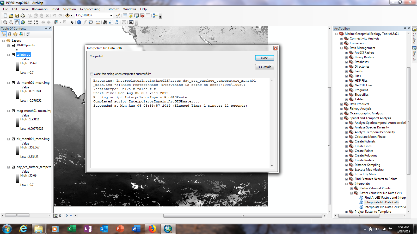
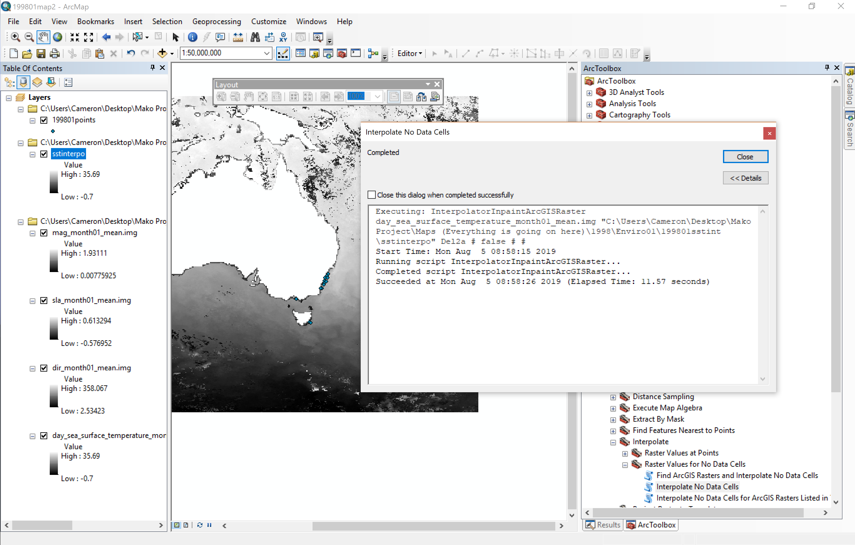
The tool isn’t completing in 0 seconds elapsed, it is certainly showing the loading bars that appeared when I had the tool functioning. Last time when I was actually getting error messages, it would just go to the error screen without loading.
I have attached screenshots of what the completed run looks like on 10.4.1 and 10.6.1, and as can be seen, there is still plenty of white on the map, which usually was interpolated when previously running the tool. I understand that the data inside the landmass
of Australia is way too large for the interpolated data to be usable, but I only want to obtain data for the coasts, so only 3 or 4 pixels wider than what the map currently is.
There is also a link under this paragraph that contains the environmental rasters. If you could please try and get it to work on your machine, and take down everything you did to make it work that would be amazing. I have a bad feeling its something that I’m
missing as a few months ago, it was working fine
My only other idea is to import all of the points from every month into one map file and clip all of the temperature layers to the extent of the points and interpolate each temperature layer from there.
If that is the same conclusion that you come to then please let me know. But I have interpolated a temperature raster of the same size when I was first downloading the files, so I have no idea what’s going on now.
Thanks again,
Cam
From: Jason Roberts <>
Sent: Saturday, August 3, 2019 12:53:32 AM To: Cameron Baber <> Cc: <> Subject: RE: Interpolation Issue Cam,
It sounds like a configuration issue. Does the tool complete very quickly (e.g. 0 seconds elapsed), claiming success without generating any output in the geoprocessing window other than a start and end time? If so, most likely it is a Python configuration problem. Send me a screenshot of trying to run the tool and I can confirm.
If not that, the next likely option is that the raster is too large and the Matlab code is reporting an “OUT OF MEMORY” error. But the tool should then fail, and you should see a red message containing that text. You and I have discussed this before, so I’m pretty sure you’d recognize this..
Best, Jason
From: <>
On Behalf Of Cameron Baber
Hi Team,
I am working with several environmental layers downloaded through MGET, and I need to interpolate some of the layers due to excessive cloud cover, and close proximity to the coast. I am using sea surface temp, current direction and magnitude as well as sea surface height anomaly. I am currently using Arc 10.6.1, and have just recently set up a machine with 10.4.1, and when I run the interpolation, like I have done many times using arc 10.4, it either fills in all the missing data as the lowest possible values, or doesn’t fill anything in. It is not giving me any errors to help me diagnose the issue, it is coming up with the little tick telling me it has successfully completed the job. I set up the second machine with 10.4.1 on it to check whether it was just machine 1 or the different version of Arc but I am still getting nothing out of both machines. I have done a bit of research online to try and help and it doesn’t seem like anyone else is having the same issue.
I am mainly wondering if there is something I’m missing about modifying the layers prior to interpolation or anything of the sort. The layers are rasters obtained through MGET and imported to a map file and I am trying to interpolate from there. I can send through a map file if that would be helpful.
Any help would be amazing, as I can’t see why this has only just started to happen now. It is pivotal that I can interpolate the layers as most of the data I am using is close to the coast of Australia and that seems to have the most missing information.
Thanks again, and I look forward to hearing back from you.
Cam
Cameron Baber MSc College of Science and Engineering James Cook University Townsville, Australia
|
- RE: [mget-help] Interpolation Issue, Jason Roberts, 08/02/2019
- Re: [mget-help] Interpolation Issue, Cameron Baber, 08/05/2019
Archive powered by MHonArc 2.6.19.